Two Tornado Touchdowns Confirmed In Region Two Tornado Touchdowns Confirmed In Region Two Tornado Touchdowns Confirmed In Region
Two Tornado Touchdowns Confirmed In Region Tornado touchdowns were confirmed in both the Hudson Valley and Connecticut  during severe storm activity in the region on Thursday, Aug. 27. The National Weather Service made the determinations late Friday night, Aug. 28 after surveying damage during the day. Hudson Valley Tornado The twister in the Hudson Valley happened just after 6:15 p.m. Thursday in Orange County in Montgomery in the area of Old Nealytown Road, according to the weather service. It was an Enhanced Fujita Scale (EF) 1 twister with 90 mph winds and a maximum path width of 600 yards and path length of 2.6 mile…
Litchfield County Isaias Update: Here's How Many Are Now Without Power, Towns Most Affected Litchfield County Isaias Update: Here's How Many Are Now Without Power, Towns Most Affected Litchfield County Isaias Update: Here's How Many Are Now Without Power, Towns Most Affected
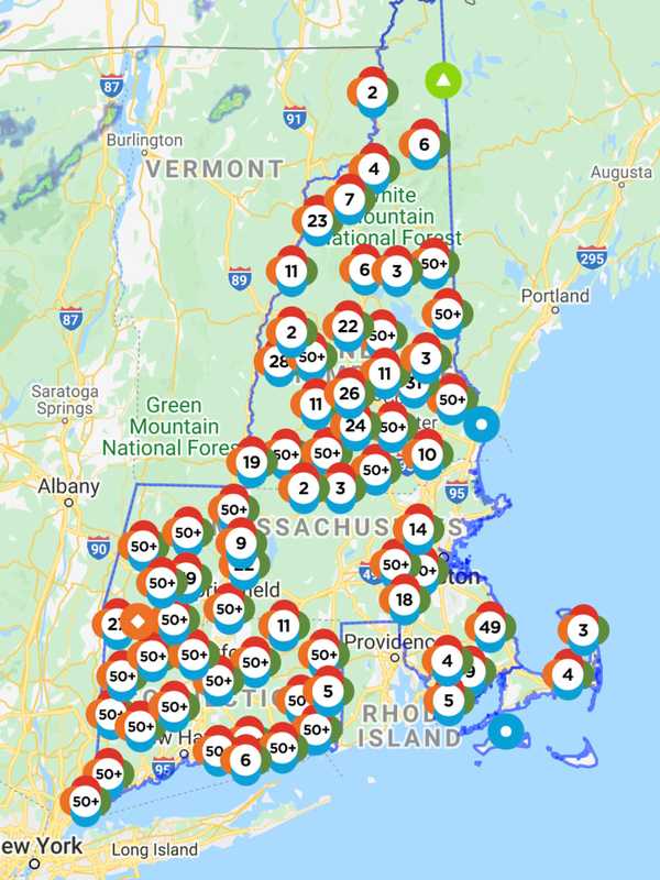
Litchfield County Isaias Update: Here's How Many Are Now Without Power, Towns Most Affected More than 66,000 Litchfield residents are still in the dark a day after Tropical Storm Isaias ripped through the region, toppling trees, felling utility poles, and sending power lines flying. Hundreds of Eversource line, tree, and service crews worked through the night after Tropical Storm Isaias and associated tornadoes tore through Connecticut causing widespread and historic damage to the company’s electric system, according to the company. In Litchfield County, as of 2:15 p.m. on Wednesday, Aug. 5, there were still 66,301 Eversource customers without power. A breakdown of acti…
WATCH: Tornado Touches Down In Jersey Shore Town Leaving Thousands Without Power WATCH: Tornado Touches Down In Jersey Shore Town Leaving Thousands Without Power WATCH: Tornado Touches Down In Jersey Shore Town Leaving Thousands Without Power
Watch: Tornado Touches Down In Jersey Shore Town Leaving Thousands Without Power UPDATED: A tornado touched down in a Jersey Shore town Tuesday morning, according to the National Weather Service -- leaving thousands without power (scroll for videos). The tornado was over Corbin City at 9:53 a.m., the NWS said. Ocean City and the surrounding area was placed under a tornado warning until 10:15 a.m. as Tropical Storm Isaias made its way north. ALSO SEE: 1.3 Million New Jerseyans Without Power, Restoration Could Take Days More than 72,900 Atlantic City Electric customers were without power as of 11:30 a.m., the outage map shows. Reports say nearly 14,000 Ocean City reside…
Tornado Touchdowns Confirmed In Region Tornado Touchdowns Confirmed In Region Tornado Touchdowns Confirmed In Region
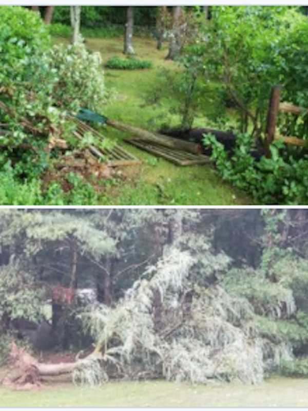
Tornado Touchdowns Confirmed In Region Tornado touchdowns were confirmed in both Connecticut and western Massachusetts during severe storm activity in the region on Sunday night, Aug. 2. A tornado touchdown was confirmed by the National Weather Service in Litchfield County Sunday night between Sharon and Lime Rock Park, where residents in the northwest corner of Connecticut saw substantial storm damage. A Tornado Watch was in effect for most of New York, Connecticut and Massachusetts with those watches upgraded to warnings in some areas, including Litchfield County, where a touchdown was confirmed in the northwest corner of Conn…
Tornado Spotted in Western Massachusetts; People Warned To Get Inside Tornado Spotted in Western Massachusetts; People Warned To Get Inside Tornado Spotted in Western Massachusetts; People Warned To Get Inside
Tornado Spotted in Western Massachusetts; People Warned To Get Inside A tornado was spotted over Blandford, a rural part of Western Massachusetts at 7:26 p.m., Sunday, Aug. 2. The National Weather Service is reporting that radar data confirms eye witness accounts of the twister. It’s being called a “damaging” tornado. Law enforcement in Sandisfield, in the southern Berkshires, is reporting that a tornado produced damage to South Main Street in town, The National Weather Service said. The tornado has produced flying debris and could be dangerous to people caught without shelter. It can destroy mobile homes and damaged roofs windows and vehicles. Tree damage i…
VIDEO: Tornado Touches Down In Toms River VIDEO: Tornado Touches Down In Toms River VIDEO: Tornado Touches Down In Toms River
Video: Tornado Touches Down In Toms River A small tornado touched down along the shore of Ocean County, the National Weather Service announced Thursday. The tornado, with winds of 70 mph, began as a waterspout in Barnegat Bay near Normandy Beach, briefly touched inland, and then returned out to sea, meteorologists said. Normandy Beach is on the barrier island between Mantaloking and Lavallette. So the tiny twister moved from the bay over the narrow strip of land -- less than a half-mile -- then back over the ocean. Winds of 70 mph matched the top straight-line winds that caused widespread damage in Toms River. The twister swirled …
New Update: Long Island Tornado Touchdown Confirmed New Update: Long Island Tornado Touchdown Confirmed New Update: Long Island Tornado Touchdown Confirmed
New Update: Long Island Tornado Touchdown Confirmed The National Weather Service has now confirmed that a tornado touched down on Long Island on Labor Day afternoon. The tornado touched down in eastern Suffolk County in Manorville, just north of Route 27 (Sunrise Highway) in the area of Dayton Avenue from 4:33 p.m. to 4:38 p.m. Monday, Sept. 2. After touching down on Dayton Avenue, the twister went northeast through the southern end of adjacent Rosewood Street and then across intersecting cross street of South Street. It then crossed the Long Island Expressway near Exit 69. Numerous downed trees and wires were reported there shortly af…
Photos: Long Island Tornado Touchdown Confirmed Photos: Long Island Tornado Touchdown Confirmed Photos: Long Island Tornado Touchdown Confirmed
Photos: Long Island Tornado Touchdown Confirmed This story has been updated. The National Weather Service has now confirmed that a tornado touched down on Long Island on Labor Day afternoon. The tornado touched down in eastern Suffolk County in Manorville, just north of Route 27 (Sunrise Highway) in the area of Dayton Avenue from 4:33 p.m. to 4:38 p.m. Monday, Sept. 2. After touching down on Dayton Avenue, the twister went northeast through the southern end of adjacent Rosewood Street and then across intersecting cross street of South Street. It then crossed the Long Island Expressway near Exit 69. Numerous downed trees and wires …
Severe Thunderstorm Watch Now In Effect: Strong Storms With Gusty Winds Sweeping Through Area Severe Thunderstorm Watch Now In Effect: Strong Storms With Gusty Winds Sweeping Through Area Severe Thunderstorm Watch Now In Effect: Strong Storms With Gusty Winds Sweeping Through Area
Severe Thunderstorm Watch Now In Effect: Strong Storms With Gusty Winds Sweeping Through Area With rounds of strong thunderstorms now sweeping through, a Severe Thunderstorm Watch is now in effect until 9 p.m. Wednesday, Aug. 21 for the entire area.  Be on the lookout for rapidly changing weather conditions into the evening, the National Weather Service said. The chance for storm activity will continue for several hours after the watch ends, until 1 a.m. Thursday, Aug. 22. During that time, more than an inch of rainfall is likely, with locally higher amounts. The main threat will be damaging winds with gusts up to 70 miles per hour possible that could bring down trees, …
VIDEO: Tornado Touches Down In Springfield VIDEO: Tornado Touches Down In Springfield VIDEO: Tornado Touches Down In Springfield
Video: Tornado Touches Down In Springfield A tornado that touched down on Rt. 22 in Springfield was captured on video Wednesday afternoon as a wave of storms passed through the area.  The National Weather Service confirmed the EF-0 tornado touched downat 2:47 p.m. and lasted nearly four minutes at speeds up to 70 mph. The funnel,  seen mostly in the first few seconds of a video posted to Facebook, is seen sending debris flying as it makes contact with the ground.  One witness reported seeing the mayhem caused as the cloud spiraled though a business in the 300 block of Rt. 22.  "At Christmas Tree Store and the shopping cart holder …
It's Official: Tornado Touched Down In Stanhope, NWS Says It's Official: Tornado Touched Down In Stanhope, NWS Says It's Official: Tornado Touched Down In Stanhope, NWS Says
It's Official: Tornado Touched Down In Stanhope, NWS Says Field investigators from the National Weather Service have determined that a tornado touched down in Stanhope, the agency announced Wednesday afternoon.  Much of northern New Jersey was under a tornado watch and the region was subjected to high winds and heavy rains between about 9 and 10 p.m. Tuesday night, but so far it appears only the Sussex County community was hit by a twister.  Details about the tornado, such as its speed and path, were still being determined. The agency's Mount Holly office expected to release that data later Wednesday.  Lenape Valley High School sus…